Duncannon Views
Duncannon Views.
Views and vistas of the Duncannon, Pennsylvania, vicinity.
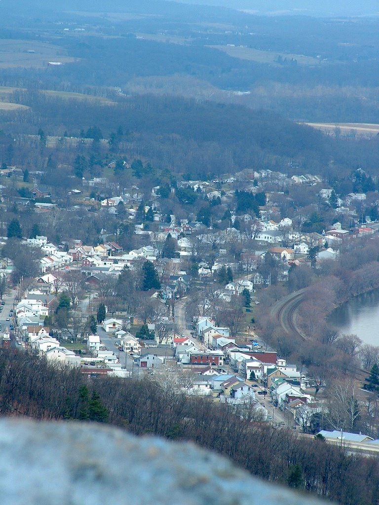
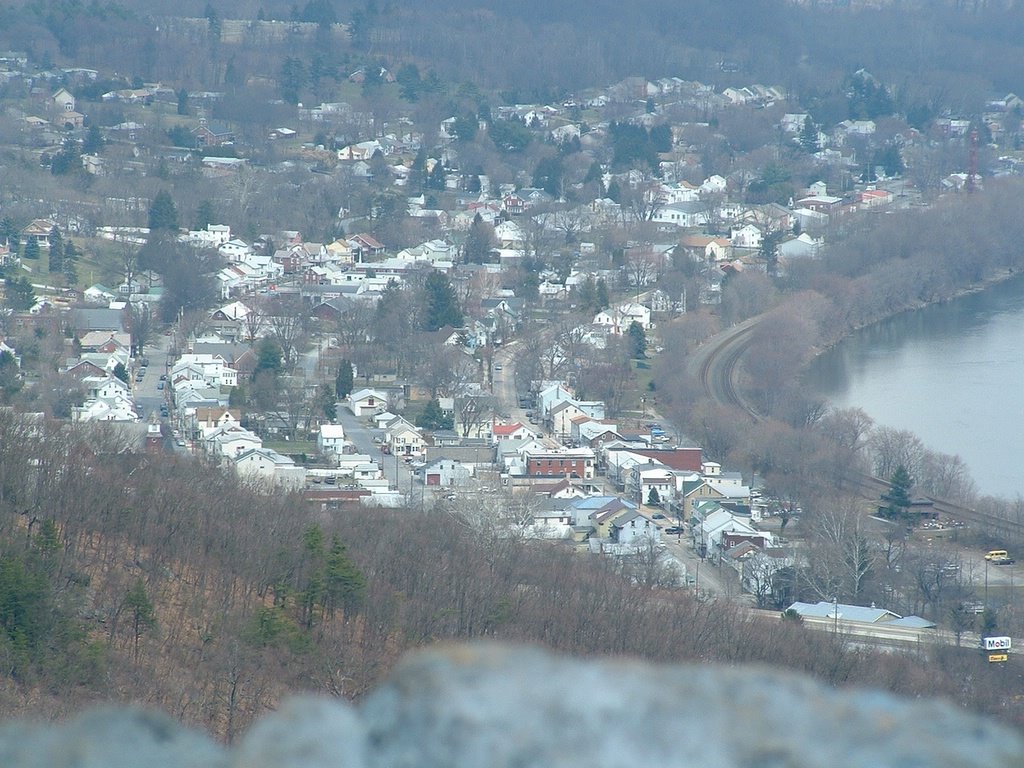
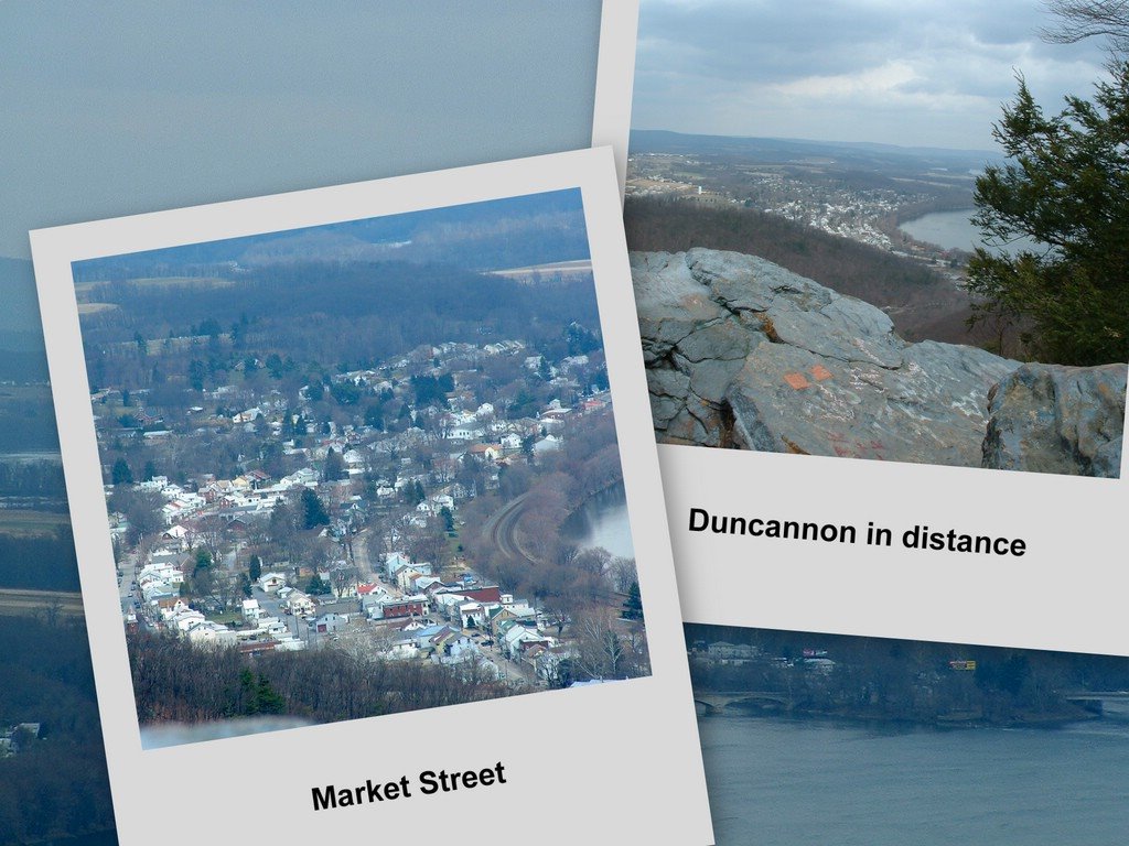
The Appalachian Trail (AT) approaches Duncannon from the south along Cove Mountain. Hawk Rock exposes an expanse of farms and woodland that sweep westward beyond Duncannon. Formerly Petersburg, Duncannon Borough nestles along the west bank of the wide and winding Susquehanna River. Immediately below Hawk Rock, Shermans Creek meanders eastward to the river. Further to the north and east is the confluence of the Juniata and Susquehanna Rivers at Duncan and Haldeman Islands. The rivers are spanned by two bridges, the venerable Juniata and the new Clarks Ferry Bridge.
The AT traverses northward through Duncannon [Can you spot the Doyle Hotel and the PRR station?] and continues over the Clarks Ferry Bridge. The AT then crosses another set of RR tracks and ascends rocks-strewn Peters Mountain on the west shore. Ruins of an improbable old farm clinging to the heights greets hikers following the white blazes. Enjoy frequent glimpses of the old iron mill town below. At the summit of Peters Mountain the AT bends east and "The Cove" south of Duncannon suddenly appears.
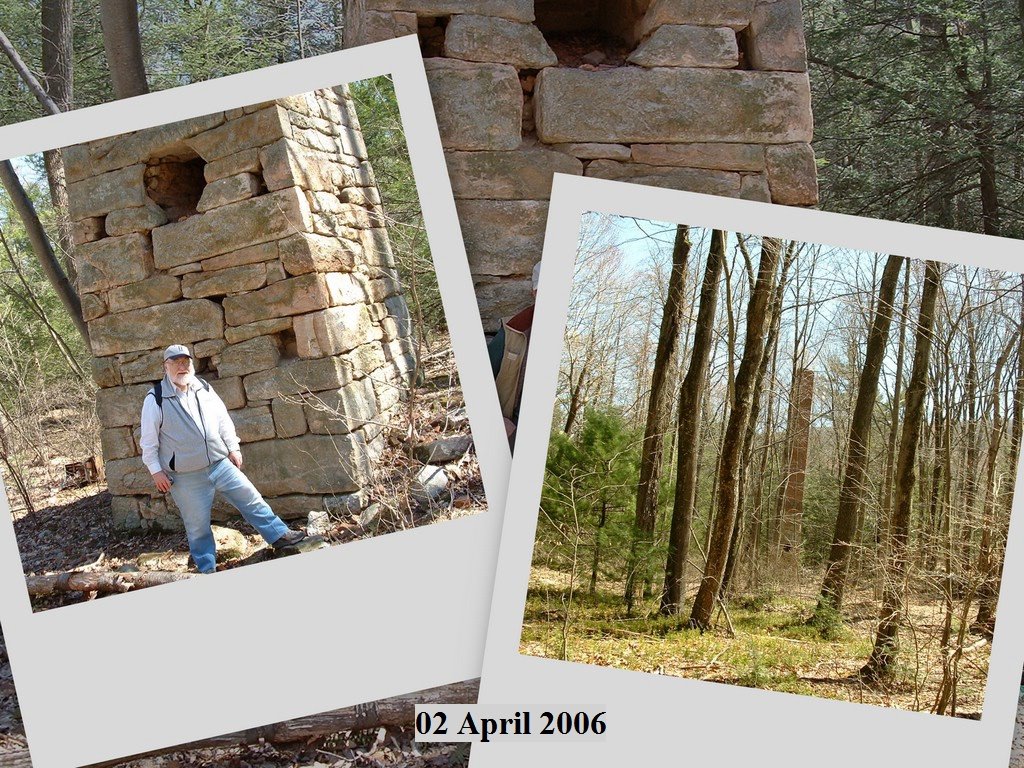
Back along Shermans Creek, the Duncannon watershed harbors an historic relic dating to 1857. The Stack, once integral to a booming sawmill operation, silently guards springs gushing from the earth which feed an unnamed tributary of Shermans Creek about five miles west of Duncannon. The Stack lies hidden only a few hundred yards laterally - just north of the AT's white blazes - and a couple hundred feet below the AT's path on Cove Mountain.
[CLICK to ENLARGE any photo; Right-click to access Print or Save functions.]
Views and vistas of the Duncannon, Pennsylvania, vicinity.
The Appalachian Trail (AT) approaches Duncannon from the south along Cove Mountain. Hawk Rock exposes an expanse of farms and woodland that sweep westward beyond Duncannon. Formerly Petersburg, Duncannon Borough nestles along the west bank of the wide and winding Susquehanna River. Immediately below Hawk Rock, Shermans Creek meanders eastward to the river. Further to the north and east is the confluence of the Juniata and Susquehanna Rivers at Duncan and Haldeman Islands. The rivers are spanned by two bridges, the venerable Juniata and the new Clarks Ferry Bridge.
The AT traverses northward through Duncannon [Can you spot the Doyle Hotel and the PRR station?] and continues over the Clarks Ferry Bridge. The AT then crosses another set of RR tracks and ascends rocks-strewn Peters Mountain on the west shore. Ruins of an improbable old farm clinging to the heights greets hikers following the white blazes. Enjoy frequent glimpses of the old iron mill town below. At the summit of Peters Mountain the AT bends east and "The Cove" south of Duncannon suddenly appears.
Back along Shermans Creek, the Duncannon watershed harbors an historic relic dating to 1857. The Stack, once integral to a booming sawmill operation, silently guards springs gushing from the earth which feed an unnamed tributary of Shermans Creek about five miles west of Duncannon. The Stack lies hidden only a few hundred yards laterally - just north of the AT's white blazes - and a couple hundred feet below the AT's path on Cove Mountain.
[CLICK to ENLARGE any photo; Right-click to access Print or Save functions.]
posted by IzzySteve at 7:40 AM
0 comments
![]()